VJOSA-NARTA, Albania — In late April, heavy machinery began moving into the Pishë Poro-Narta protected landscape on Albania’s Adriatic coast without permits or public notice. Bulldozers and excavators felled coastal pine trees, flattened sand dunes, and cut new roads through previously untouched habitat. Then, barbed wire fences went up along the shoreline. The incursion was the realization of a luxury resort development backed by Jared Kushner, U.S. President Donald Trump’s son-in-law. The development plans of Kushner’s Affinity Partners, a private equity fund, stretch from the uninhabited Sazan Island into the Vjosa-Narta Protected Landscape, the delta region of Albania’s Vjosa River that includes Pishë Poro-Narta. Roughly twice the size of Paris, the Vjosa-Narta area shelters flamingos, Dalmatian pelicans (Pelecanus crispus), loggerhead sea turtles (Caretta caretta) and more than 70 endangered species, among them the Mediterranean monk seal (Monachus monachus). Neither Affinity Partners nor the office of the prime minister of Albania responded to Mongabay’s requests for comment. Aerial drone video of demonstrators gathering at Dalan Beach on June 6 for a rally near the site of the original resort-construction site. Footage by Stefan Lovgren for Mongabay. When protesters arrived at the site, security guards confronted them. Video of a demonstrator being dragged across the dunes on May 30 near the village of Zvërnec went viral. Soon demonstrations erupted in Tirana, the Albanian capital, in what has since been dubbed the Flamingo Revolution. The protests have grown larger every day, with tens of thousands demanding accountability for corruption, an end to…This article was originally published on Mongabay
DEDURU OYA, Sri Lanka – On April 16, eight members of Priyantha Kumara’s family including his wife, son, brother, father-in-law, and four other relatives were swept away by strong currents in the Deduru Oya, a river in Sri Lanka’s North Western province. Sri Lanka Police reported more than 30 drowning deaths between April 12 and 21 this year, underscoring the risks posed by flooding rivers. Sri Lanka Police media spokesperson Udaya Kumara Wootler told Mongabay that 376 individuals have died due to drowning in rivers last year while 595 fatalities were reported in 2024. Buddhika Sampath, spokesperson for the Sri Lanka Navy told Mongabay that the Navy Diving Unit recovered 148 bodies of people between May 2022 and May 2023. While the police are yet to disclose official statistics of deaths due to drowning from January to May 2026, the number of reported incidents show over 50 fatalities. Kumara is a resident of Gopallawa in the northwestern district of Kurunegala. His son had requested that they all go for a bath in the river. The group had been bathing at a popular spot named Kuriyagas Mankada when they met the tragedy. “My son was only 13 years old, and he was a bright student,” Kumara told Mongabay. “My brother was about to hold a housewarming ceremony at his newly built house. But all these dreams were shattered within seconds. My father used to take us to this same spot to bathe when we were young. But the river has changed…This article was originally published on Mongabay
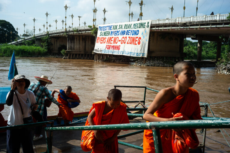
BANGKOK — More than 600 residents of Chiang Mai and Chiang Rai provinces embarked May 31 on a roughly 68-kilometer, six-day ‘peace walk’ to demand the Thai government take action on the river pollution crisis that has seen Thai rivers polluted with heavy metals. The ensemble of affected residents, civil society groups, monks and students marched from Tha Ton subdistrict in Chiang Mai to the city of Chiang Rai in northern Thailand, reaching their destination on June 5, World Environment Day. For more than a year, Thailand’s Pollution Control Department has reported dangerous levels of arsenic, mercury, cadmium and other heavy metals in rivers across northern Thailand, with mining operations across eastern Myanmar suspected to be responsible for the pollution. “We are walking because our rivers are slowly dying,” Pianporn Deetes, executive director of the Rivers and Rights Foundation, which helped to organize the peace walk, told Mongabay by phone. “Toxic contamination from unregulated mining upstream is already affecting water, fish, food, livelihoods, and public health. We do not want to wait until more people become sick. This is an emergency.” Pianporn said the walk (42 miles) was about taking collective action to share information, document impacts and build public pressure in a bid to force the government to address the issue, which Pianporn said has, so far, been lacking. “Monitoring has improved, but action has not matched the scale of the crisis,” she said. “We need urgent diplomatic engagement with neighboring countries, stronger health monitoring, transparency, and action to…This article was originally published on Mongabay
Greek drivers’ risky habits, including phone use, fatigue, alcohol-related driving, and low seatbelt use, are fueling Greece’s road safety crisis. Credit: Flickr / Gina Collecchia / CC BY NC ND 2-0
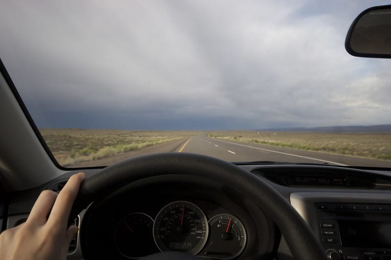
Greek drivers display some of the most dangerous road behavior in Europe, with new findings showing that risky habits such as phone use, fatigue, alcohol-related driving, and low seatbelt compliance remain widespread among motorists, especially younger drivers.
According to the 16th Responsible Driving Barometer released by the VINCI Autoroutes Foundation, 66 percent of Greek drivers say they use their phones while driving, 41 percent admit to driving while severely fatigued, and 10 percent say they have driven after consuming alcohol.
Despite these behaviors, 97 percent of Greek drivers describe their own driving in positive terms. The contrast suggests that many motorists underestimate the risks they take behind the wheel, even when those risks are among the leading causes of serious crashes.
The survey, conducted by Ipsos BVA, polled 12,100 people across 11 European countries and highlighted a troubling gap between how Greek drivers see themselves and how they actually behave on the road.
Young drivers raise particular concern
The survey also points to alarming habits among younger drivers in Greece. Among those aged 16 to 24, 48 percent say they drive without wearing a seatbelt, while 16 percent admit they occasionally drive under the influence of alcohol.
These figures indicate that road safety remains a serious cultural issue, particularly among younger motorists who may be more likely to normalize dangerous behavior such as not wearing a seatbelt, using a phone, or driving after drinking.
Road deaths show scale of Greece’s safety issue
The survey findings come at a time when Greece is also ranked among Europe’s five most dangerous countries for driving, according to data from the European Transport Safety Council.
Greece recorded 62 road deaths per one million residents in 2024, up from 60 per one million in 2023. While the increase may appear insginificant, it points to a wider road safety problem at a time when several other European countries are making progress in reducing traffic fatalities.
In the 2024 rankings, Greece placed fifth among the most dangerous European countries for road users. Serbia topped the list with 78 deaths per one million residents, followed by Romania with 77, Bulgaria with 74, Croatia with 64, and Greece with 62.
Greece has not historically been at the very top of Europe’s road-death rankings, but its current position shows that road safety remains a persistent national challenge. The country’s performance is also concerning because Croatia, which remains just above Greece in the ranking, has shown signs of improvement.
AI cameras reveal Greek drivers’ risky habits in Athens
Recent data from AI-powered traffic cameras in Athens adds further evidence that risky driving behavior remains widespread.
Eight pilot AI traffic cameras installed in the Greater Athens area have already recorded thousands of serious violations. In roughly one month, four of the cameras detected 39,543 major offenses, including running red lights, using a mobile phone while driving, and exceeding speed limits.
The violations were recorded at some of Athens’ busiest locations, including Syntagma Square and Syngrou Avenue. Separate data showed that on Syngrou Avenue alone, more than ten thousand violations related to seatbelt use and mobile phones were recorded between December 25 and January 28, along with more than 1,500 speeding violations.
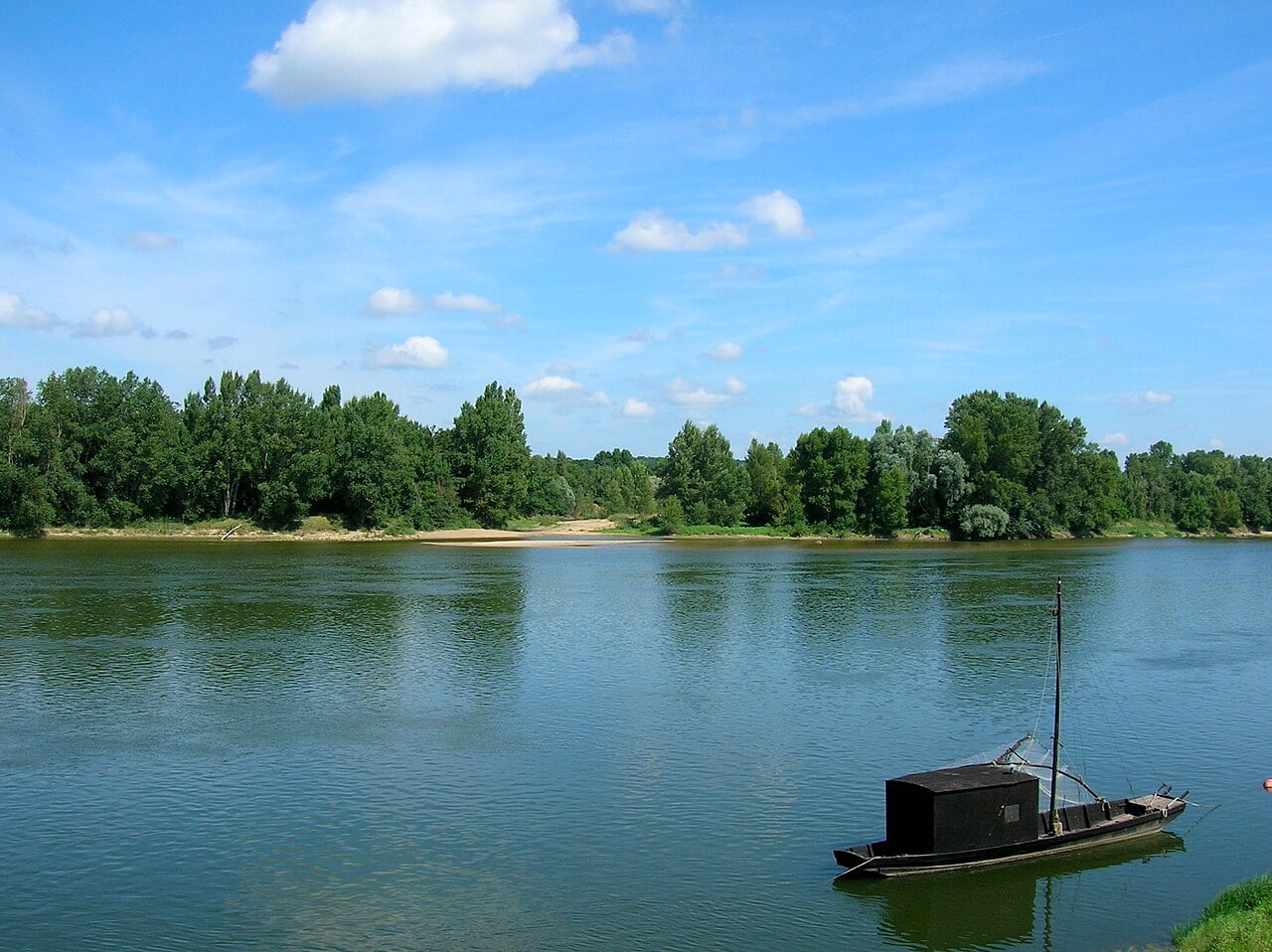
The Loire River, likely part of the Eridanos River of Greek mythology. Credit: Wikimedia Commons, CC-BY-SA 3.0, LPLT
The Eridanos River of Greek mythology is a mysterious river whose location has long been debated. Numerous real-world rivers around Europe have been suggested, but some scholars believe it is completely mythical and corresponds to no real-world location. Nevertheless, some may wonder where this river might actually be situated.
The Eridanos River of Greek mythology
To try to understand which real-world river it might correspond to, we first need to look at what ancient sources say about it. The Eridanos River is most famous for its connection with Phaethon and amber. In the relevant legend, it’s the river into which Phaethon crashes after he steals the chariot of the sun god.
Phaethon’s sisters, the Heliades, grieved the loss of their brother, and the gods transformed them into poplar trees. These trees, in turn, supposedly produced amber for which the river was well known. Numerous scholars have attempted to use this information to identify this body of water.
Furthermore, we know that the Eridanos River cannot have been an obscure, minor river. Hesiod mentions it in his list of the offspring of Oceanus. Eridanos appears first in the list, and Hesiod even calls it “deep-swirling,” which is an expression normally reserved for the great Oceanus itself.
Where was the Eridanos River?
With these facts in mind, what have scholars argued about the location of this river? Well, one popular candidate is the Vistula River, since this flows through Poland and leads to the Baltic Sea. This was a major source of amber in the ancient world, and this fits the criterion of the Eridanos River being a source of amber.
Furthermore, Herodotus associates the Eridanos River with a certain “northern sea.” Since the Baltic Sea is to the north of Greece, it could fit Herodotus’ description. However, another popular candidate is the Po River, which flows through northern Italy and enters the Adriatic Sea. In fact, several ancient sources explicitly identify the Eridanos with this real river. At first, that might seem to settle the matter. However, it’s more complicated than that.
A closer look at Herodotus’ description
Herodotus, in the fifth century BC, was not the first person to mention the Eridanos River. As we saw earlier, that was Hesiod. However, he does seem to provide the earliest useful description of it. His description reads:
“As to the extremities of Europe towards the West, I am not able to speak with certainty: for neither do I accept the tale that there is a river called in Barbarian tongue Eridanos, flowing into the sea which lies towards the North Wind, whence it is said that amber comes; nor do I know of the real existence of the Cassiterides from which tin comes to us… However that may be, tin and amber certainly come to us from the extremity of Europe.”
As we can see from this description, the Eridanos River was explicitly said to flow into the sea which lies towards the North Wind, and Herodotus refers to this region as the “extremity of Europe”. This definitively rules out the Po River, which flows into the Adriatic Sea near Greece itself.
Does this mean that the Vistula River is the most likely candidate? At first, that might seem to match Herodotus’ reference to the “extremity of Europe” and the fact that the river flowed into the sea towards the North Wind. However, that does not work either. Herodotus prefaces this passage by referring to the “extremities of Europe towards the West”.
Since the Vistula and the Baltic Sea are essentially directly north of Greece, this does not match this aspect of Herodotus’ description.
Jason and the Argonauts
Jason and the Argonauts disembark at Colchis, Charles de La Fosse, 1672. Credit: Wikimedia Commons, CC-BY-SA 3.0
The Argonautica, by Apollonius Rhodius of the third century BC, reveals the answer to this conundrum. Although it contains some fictional geography, it is clear about where the Eridanos River was supposedly situated, and this aligns perfectly with Herodotus’ description.
According to Apollonius, Jason and the Argonauts sail from the Black Sea through the Danube and then reached the Adriatic Sea via a fictional channel between the two. They then sail up into the Eridanos River, actually signifying the Po River in this context. Eventually, they make it to the Rhodanus River, or the Rhone as it is known today, a body of water which flows through France relatively close to the Po River source and then spills into the the Mediterranean Sea on the country’s southern coast.
This is significant because it demonstrates that the Greeks believed the Po and the Rhone were connected. In fact, other ancient texts attest to this same belief. Consequently, this means Apollonius is presenting the Rhone as part of the Eridanus River.
How the Argonautica reveals the true location of the Eridanos River
At this point in the Argonautica, the true nature of the Eridanos River is made clear. Apollonius writes:
“Thence they entered the deep stream of Rhodanus which flows into Eridanus; and where they meet there is a roar of mingling waters. Now that river, rising from the ends of the earth, where are the portals and mansions of Night, on one side bursts forth upon the beach of Ocean, at another pours into the Ionian Sea, and on the third through seven mouths sends its stream to the Sardinian sea and its limitless bay.”
Apollonius refers to the Eridanos River as having three mouths. One arm of the river flows into the Ionian Sea, which is an ancient reference to the Adriatic Sea. That is the arm of the river that Jason and the Argonauts have just been described as sailing up. Another one of the arms of the river is said to flow into the Sardinian Sea. That would be the Rhone, in accordance with Apollonius who explicitly presents the Rhodanus (the Rhone) as part of the Eridanos.
The third arm is the final piece of the puzzle. According to Apollonius, it flows into the “beach of Ocean.” Incidentally, this matches Herodotus’s description of the Eridanos flowing into the sea on the other side of Europe, which doesn’t match the Rhone nor the Po. The notable point is that this shows that the Ancient Greeks believed the Po, the Rhone, and a third river were all part of one enormous waterway in Europe, which they referred to as the Eridanos.
What was the third arm of the Eridanos River?
A few lines later, Apollonius refers to the mouth of the river in the southern part of France as the middle of the three mouths of the Eridanos. With the Po River having the mouth closest to Greece, and the Rhone having the intermediate one, the third mouth must have been even further west. This, again, is in harmony with Herodotus’ description, which associated the Eridanos with the western extremity of Europe.
Based on this, the only plausible candidate for the third arm of the Eridanos River is the Loire. This is a river whose mouth is further west than the mouth of the Rhone. It flows out into the Atlantic Ocean on the western side of France and is located towards the north—another detail of Herodotus to keep in mind. Furthermore, it flows quite close to the Rhone near its source, making sense of the belief that they were connected.
In summary, it appears that the Greeks imagined the Loire, the Rhone, and the Po Rivers to all be connected. The Greeks received their amber via the Po River, since it was the final part of the Amber Road which originated in the Baltic Sea. However, they believed that the Po was connected to the Loire.
This perfectly matches up with Herodotus’ description of the Eridanos River in its entirety. As we saw, he claimed it flowed into the sea on the other side of Europe and associated it particularly with the north and the west, which points to the Loire.