Normal view

Real Pirates of the Caribbean Shipwrecks Found in the Bahamas for the First Time

5 June 2026 at 21:59
An AI-colored reconstruction of an 18th-century depiction of pirate Henry Avery
An AI-colored reconstruction of an 18th-century depiction of pirate Henry Avery. Credit: GR Archive

Six shipwrecks linked to the real ‘Pirates of the Caribbean‘ have been found in Nassau’s harbor in the Bahamas for the first time, an international expedition announced.

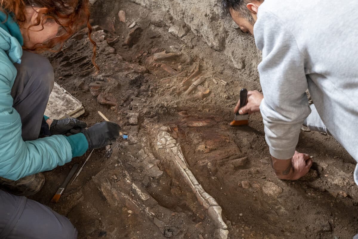
The New Providence Pirates Expedition conducted the survey in late 2025 after receiving the first official permission to dive in the harbor’s restricted zone. Marine archaeologist Sean Kingsley and Michael Pateman, the Bahamas’ ambassador for history and culture, co-directed the project.

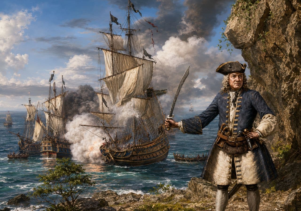
Three of the six wrecks are tied to the golden age of piracy, a period from the 1690s through the 1720s when Nassau served as a base for buccaneers, including Blackbeard, Henry Avery, Calico Jack Rackham, and Anne Bonny.

The standout find is a charred wooden hull fastened with wooden treenails, a method typical of 18th-century shipbuilding, burned down to the waterline. Pateman said that pirates burned seized ships after stripping them to remove evidence of their crimes.

Burned hull may belong to Avery’s missing pirate ship

Researchers believe the hull may be the Fancy, last commanded by Avery. In 1695, his crew seized gold, silver, sapphires, emeralds, and diamonds from Mughal Empire vessels, a haul worth around $150 million today.

The ship was never found afterward. The wreck fits the Fancy’s estimated age, size, and construction, though no formal identification has been made.

Pirates of the Caribbean shipwrecks found in the Bahamas for the first time reveal Nassau as history's most notorious golden age pirate port. pic.twitter.com/9WrS1pxMI1

— Tom Marvolo Riddle (@tom_riddle2025) June 5, 2026

A second site about 20 miles east of Nassau yielded iron cannons, 25 lead musket balls, a grinding stone for sharpening swords, and a swivel gun. Kingsley described swivel guns as pivot-mounted weapons pirates used to open fire on enemy crews at close range.

A third site under Nassau’s old bridge produced hull planks, rigging, wine bottles, wooden crates, and galley bricks. Nearby, researchers recovered 143 clay tobacco pipes marked with a horse, unicorn, crown, and the English royal crest.

The style suggests they were made in London around the 1740s. Kingsley said the cargo reflects Nassau settling back into regular trade after the pirate era closed.

Bahamas shipwrecks reveal the real ‘Pirates of the Caribbean’

The discoveries came despite significant disturbance to the harbor floor from years of dredging. Kingsley said the finds are likely only a fraction of what may remain and estimated that dozens more wrecks could be hidden in the harbor. The team plans to return using underwater drones but has found no evidence of treasure.

Until now, no shipwrecks connected to Caribbean pirates had been found in the Bahamas, even though Nassau served as the pirates’ primary base throughout that period.

The findings are featured in a documentary series, Mystery of the Pirate King’s Treasure, now on Wreckwatch TV, and in the latest issue of Wreckwatch magazine.

New Pompeii Discovery Reveals Equine Skeleton in Ancient Bread-Making Workshop

5 June 2026 at 20:30
The skeleton of an equine at ancient bread making complex in Pompeii
The skeleton of an equine at an ancient bread-making complex in Pompeii. Credit: Pompeii Archaeological Park

Archaeologists in Pompeii have uncovered an equine skeleton inside a bread-making workshop at one of the city’s most celebrated ancient complexes, opening a new chapter in the understanding of how humans and animals lived and worked together nearly 2,000 years ago.

The remains were discovered at the Insula of the Chaste Lovers, a large residential and commercial site renowned for its striking “chaste kiss” fresco, painted inside the dining room of the owner’s home.

The complex includes a working bakery, storage rooms, processing spaces, and the owner’s private residence. Researchers had previously found other equids at the site’s stables, where animals were used to power grain mills and transport the grain needed for bread production.

Pompeii’s chaste lovers complex was also a busy bakery

This latest skeleton was not found in the stables. Researchers found it in a separate room, suggesting the animal had fled there during the catastrophic eruption of Mount Vesuvius in 79 AD.

The excavation brought together archaeologists and specialists from the Applied Research Laboratory, including experts in animal remains, plant life, and human bones. This interdisciplinary approach has become one of the most important aspects of modern archaeological research at the site.

Archaeologists excavating the skeleton of an equine
Archaeologists are excavating the skeleton of an equine. Credit: Pompeii Archaeological Park

Laboratory analysis is still ongoing. Researchers expect it to reveal more about the animal’s specific role in the production complex and the conditions it faced during the eruption.

The study could also contribute to a wider understanding of how animals responded to the disaster in real time, adding detail to the reconstruction of those final, chaotic hours.

Pompeii equine skeleton suggests a desperate Vesuvius escape

Gabriel Zuchtriegel, director of the Pompeii Archaeological Park, said that Pompeii offers far more than beautiful frescoes and ancient objects.

He said it gives researchers the opportunity to understand lives that were ended by the eruption, and that this extends to animals as well as people. The horse or donkey, he noted, was found inside a house with remarkable frescoes that also served as a working mill and bakery.

Its location in a room away from the stables points to an attempt to escape the eruption. Zuchtriegel called the excavation a strong example of the daily multidisciplinary collaboration at the site and said ongoing lab results will continue to offer significant scientific value.

Pompeii continues to yield new layers of ancient life. The site preserves not just objects and artwork but the full texture of daily existence, including the bonds between people, animals, and the spaces they shared.

The equine skeleton discovered in Pompeii’s ancient bread workshop is the latest reminder that the city still holds stories waiting to be told.

Ancient Maya Monument Reveals Oldest Known Calendar Date in Mexico

5 June 2026 at 19:50
Stela 45 monument. Back face, left side, front face, and right side
Stela 45 monument. Back face, left side, front face, and right side. Credit: Kenichiro Tsukamoto / CC BY-NC 4.0

Archaeologists working at an ancient Maya site in southern Mexico have found what they say is the earliest known evidence of Maya kingship and calendar use in the region.

Kenichiro Tsukamoto, an archaeologist at the University of California, Riverside, led the study published in Ancient Mesoamerica. His team analyzed three stone monuments at El Palmar, a site in southeastern Campeche, Mexico.

One of them, Stela 46, carries an inscription dated to A.D. 180. That makes it the oldest confirmed “Long Count” calendar date discovered in the Maya Lowlands.

The Long Count is a dating system the ancient Maya used to record historical events in a fixed chronological order. Before this discovery, a stone monument at Tikal held that record with a date of A.D. 292. The El Palmar inscription predates it by 112 years.

Stone monuments link Maya kingship to an ancient calendar

What distinguishes Stela 46 from earlier finds is its direct connection to historical rulers and events. A king named Ajaw K’al Ubaah acceded to the throne in A.D. 131. Some 49 years later, in A.D. 180, he commissioned the stela as part of a royal ritual.

Alongside the Long Count, the inscription also incorporates the 260-day divinatory calendar, binding the royal event to a specific ceremonial date. No earlier Long Count inscription had ever been linked to a named ruler, the researchers said.

Stela 46. Left side, front face, and right side
Stela 46 monument. Back face, left side, front face, and right side. Credit: Kenichiro Tsukamoto / CC BY-NC 4.0

To read the heavily worn carvings, researchers combined traditional photography with photogrammetry and a high-resolution 3D scanner called Artec Spider II. The device captures detail as fine as 0.1 millimeters (0.0039 inches). It uncovered inscriptions that scholars had previously missed entirely.

The carvings also show that the king carried two royal titles, pointing to an already established order of royal authority at the site.

Monument traces El Palmar’s rulers back 17 generations

A second monument, Stela 20, strengthened the picture of Maya kingship at El Palmar. Its text identifies the ruler who commissioned it as the 17th king in a successive royal line.

Using the estimated average reign of 22.5 years for Classic Maya kings, the team calculated that the lineage’s first ruler likely rose to power between A.D. 102 and 154. That closely matches the accession date recorded on Stela 46.

A third monument, Stela 45, records the accession of a ruler named Tz’u Chak Ahk in A.D. 342. Together, the three stelae trace a royal dynasty from the second century A.D. to at least A.D. 884, one of the longest recorded among ancient Maya kingdoms.

Tsukamoto noted that El Palmar rose during a turbulent period. Several large Maya polities collapsed around A.D. 150 due to drought, soil erosion, and political instability. El Palmar appears to have grown as a new power center in their place.

The study concludes that calendar systems did more than track time. At El Palmar, they helped rulers legitimize and hold power for more than 700 years.

https://youtu.be/2sGZRo5POf8?si=wF6pXkzKrpiZuZ88

Ancient Wall in Greece Collapses Into Family’s Yard, Trapping Them Between Safety and Heritage Rules

5 June 2026 at 01:20
Panoramic view of Veria, Greece
Panoramic view of Veria, Greece, where part of an ancient wall recently collapsed into a private yard near the Archaeological Museum. Credit: Zisis Tsampalis / Wikimedia Commons / CC BY-SA 3.0

A section of an ancient wall in Veria, northern Greece, collapsed into the backyard of a private home, raising safety concerns for residents and triggering a dispute between local authorities over who must remove the fallen stones.

The incident occurred near the Archaeological Museum of Veria, in Central Macedonia, where parts of the city’s historic fortifications still stand close to residential properties. Large stones from the wall fell into the yard, where children reportedly play, leaving the family worried about further collapses, especially during heavy rainfall.

Residents say the problem has not only created a physical hazard but has also exposed a familiar challenge in Greece: the difficulty of managing ancient heritage when it intersects with everyday life.

Homeowner caught between heritage rules and safety risks

The homeowner told local broadcaster MEGA that he has become caught in a bureaucratic dispute between the Ephorate of Antiquities and the Municipality of Veria.

The homeowner said the Ephorate of Antiquities treats the wall as a monument under its authority, while the municipality argues the fallen stones are now debris on private property.

However, he says officials told him they do not have enough workers to remove the fallen stones. Meanwhile, the municipality reportedly argues that once the stones landed inside private property, they became rubble and therefore the homeowner’s responsibility.

The homeowner says this leaves him in an impossible position. On the one hand, authorities allegedly told him to arrange the cleanup himself. On the other hand, he says he received instructions not to touch the stones because they form part of an ancient monument and may be needed for future restoration work.

As a result, the family fears that moving the material could expose them to accusations of mishandling antiquities. For now, residents say the authorities have placed two containers at the site, but they have not delivered a permanent solution.

Βέροια: Κατέρρευσε τμήμα αρχαίου τείχους στην αυλή του#ingr #news #βεροια pic.twitter.com/qL3s3A4AZY

— in.gr/news (@in_gr) June 4, 2026

Ancient stones, modern bureaucracy

The collapse has sparked frustration in Veria because it highlights the tension between heritage protection and public safety. Greece’s archaeological landscape often overlaps with homes, roads, and modern infrastructure, especially in cities with continuous habitation from antiquity to the present day.

Veria is one such city. Located in Central Macedonia, it has deep historical roots and played an important role in ancient, Roman, Byzantine, and Ottoman periods. According to the Ephorate of Antiquities of Imathia, evidence suggests that Veria acquired a city wall and a basic urban plan around the second half of the 4th century BC.

That historical depth gives the city much of its cultural value. However, it also creates practical responsibilities. When ancient remains stand beside private homes, any damage or deterioration can quickly turn into a matter of both archaeology and civil protection.

Residents in Veria, Greece urge action after ancient wall collapse

Residents have urged the competent authorities to intervene quickly, warning that more sections of the wall could collapse. Their main concern remains the safety of children and families who live next to the site.

The case now raises broader questions about how local and national authorities should coordinate when protected monuments create risks in residential areas. While the stones may hold archaeological value, residents argue that the authorities must act before the situation causes an injury.

Stonehenge Mystery Deepens as Glaciers May Have Moved Six-Ton Altar Stone

5 June 2026 at 00:15
Stonehenge Altar Stone
Stonehenge Altar Stone. Credit: Wikimedia Commons / Public Domain

The massive Altar Stone at Stonehenge may have received some help from ancient glaciers on its long journey to southern England, but people still likely carried it much of the remaining distance, according to new research.

The study, led by Anthony J. I. Clarke and published in the Journal of Quaternary Science, examined the possible origins and transport routes of the six-ton sandstone monument that sits at the center of Stonehenge.

Researchers have long believed the Altar Stone came from northeast Scotland, roughly 700 kilometers (435 miles) from Stonehenge. However, exactly where the stone originated and how it reached Salisbury Plain have remained major archaeological mysteries.

Searching for the stone’s birthplace

The team combined geological analysis with computer models of ancient ice sheet movements to investigate whether glaciers could have transported the stone southward during the last Ice Age. Scientists focused on the Orcadian Basin, a large geological region in northeast Scotland that has been proposed as the stone’s source.

How did a 6-ton stone reach Stonehenge from Scotland?

Researchers found that glaciers may have moved the monument's famous Altar Stone part of the way. But ancient people likely completed the final journey, hauling the massive rock hundreds of kilometers across Britain. pic.twitter.com/mQFbTIb3ve

— Tom Marvolo Riddle (@tom_riddle2025) June 4, 2026

The study compared the Altar Stone’s mineral signature with sandstone formations across the basin. Researchers looked specifically at the ages of zircon grains embedded in the rock. These grains act like geological fingerprints and can help identify where a stone was formed.

The results pointed most strongly toward Caithness in mainland northeast Scotland. Sandstones from that region showed the closest match to the Altar Stone’s zircon age patterns.

Ice movement presents a problem

Although Caithness appears to be the best geological match, computer models revealed a complication.

Ancient glaciers in the area mostly moved toward the northeast rather than toward southern England. The models showed only a limited pathway that could have carried material southeast toward Dogger Bank, a now-submerged area beneath the North Sea.

That finding makes a direct glacial journey to Stonehenge unlikely. Researchers concluded that glaciers alone could not explain how the stone reached its final location.

Human transport still likely

Even if glaciers carried the stone as far as Dogger Bank, people would still have needed to move it about 400 kilometers (250 miles) to Stonehenge.

The study also noted another challenge. Dogger Bank was flooded by rising sea levels after the Ice Age before the Altar Stone is thought to have arrived at Stonehenge. This creates a timing problem for any theory relying entirely on glacial transport. As a result, researchers suggest that ice may have played only an intermediate role in the stone’s journey.

The findings support the idea that Neolithic communities were responsible for moving the enormous stone over great distances. While glaciers may have shortened part of the route, substantial human effort would still have been required to bring the Altar Stone to Stonehenge, one of the world’s most famous prehistoric monuments.

The study adds a new piece to the puzzle of how ancient builders assembled Stonehenge and highlights the remarkable achievements of the people who constructed it thousands of years ago.

Rare Roman Gold Ring Found in England Sheds Light on Britain’s Ancient Revolt

4 June 2026 at 22:30
AI reconstruction of the Ilminster ring
AI reconstruction of the Ilminster ring. Credit: Greek Reporter Archive

A rare Roman gold ring discovered by an amateur metal detectorist in southwest England is offering new insights into a turbulent period of Roman Britain nearly 1,700 years ago.

The ring was found near Ilminster in Somerset by Kevin Minto, a former soldier and truck driver who has spent years searching local fields with a metal detector. Experts have described the find as one of the most significant Roman discoveries made in the region in recent years.

An exceptional example of Roman craftsmanship

Weighing 48 grams (1.7 ounces), the ring is unusually large compared with most Roman jewelry recovered in Britain. At its center is a finely carved gemstone depicting Victory, the Roman goddess of triumph, driving a two-horse chariot. Researchers say the craftsmanship is exceptional, and comparable examples are rarely found in Britain.

The discovery was made in an area where Minto had previously uncovered a hoard of nearly 300 Roman coins. He continued returning to the site over several years, eventually finding the gold ring and other Roman-era objects.

Under Britain’s treasure laws, significant archaeological finds must be reported to authorities and assessed before museums can acquire them. The South West Heritage Trust has now acquired the ring and coin hoard after raising £78,010 (about $105,000). The artifacts will eventually become part of the collection at The Museum of Somerset.

A clue to political unrest in Roman Britain

Researchers believe the ring belonged to a wealthy member of Roman society. South Somerset was a prosperous region during the Roman period, known for its villas, agricultural estates, and trade connections along the nearby Fosse Way, one of Roman Britain’s most important roads.

The discovery may also shed light on a dramatic chapter in British history. According to museum officials, the ring and accompanying objects were likely buried around A.D. 297 during the aftermath of the Carausian Revolt.

A rare Roman gold ring discovered in Somerset, England, is shedding light on a turbulent chapter of Roman Britain. Researchers believe the ring was buried around A.D. 297 during the aftermath of the Carausian Revolt and remained hidden for more than 1,700 years. #Archaeology pic.twitter.com/K42ig1eBjt

— Tom Marvolo Riddle (@tom_riddle2025) June 4, 2026

The rebellion began in A.D. 286 when Carausius declared himself ruler of Britain and parts of northern Gaul, creating a breakaway state that lasted for nearly a decade. Roman forces eventually regained control of Britain in A.D. 296.

Archaeologists suggest the valuables may have been hidden for protection during this period of political uncertainty and never recovered by their owner.

Amal Khreisheh, senior curator at the South West Heritage Trust, said the artifacts help researchers understand how people in South Somerset lived through a time of instability and change.

Bringing Roman history to local communities

Before the ring goes on permanent display, it is being used in community outreach programs. Local schoolchildren have already been given the opportunity to examine the ring and some of the coins.

According to Khreisheh, many students have been fascinated by the mystery surrounding the find, asking who owned the ring and why it was buried. While those questions remain unanswered, the discovery has created a direct link between modern Somerset and its Roman past.

❌